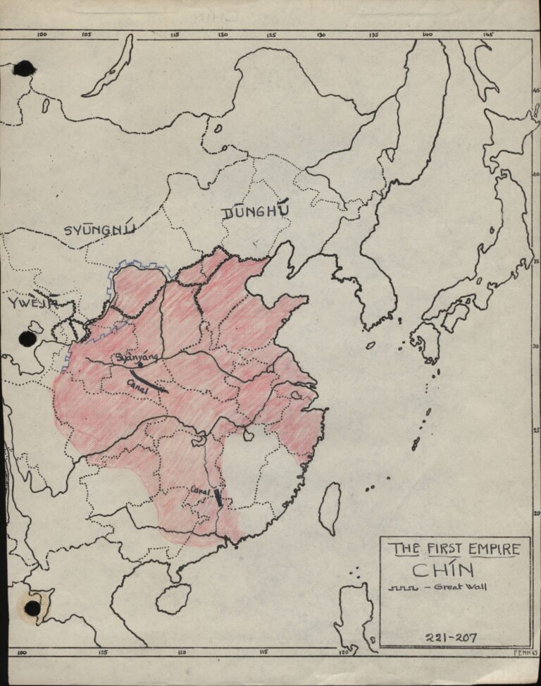
Henry drew and compiled hundreds of maps over his lifetime. Many of these maps are of parts of China and Asia. Below is a map that Henry drew in 1945 of the first empire of China, and it includes the Great Wall of China1.
References:
Fenn Collection. College of East Asian Studies, Wesleyan University.